The Parish of Wappenbury
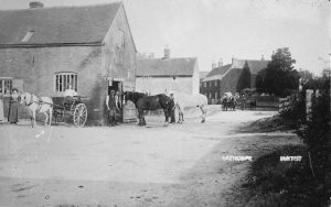
The parish of Wappenbury and hamlet of Eathorpe lie on the banks of the Leam, about 4 miles north-east of Leamington Spa. The river divides Wappenbury proper from Eathorpe on the east and from the parish of Hunningham on the south. Wappenbury contains the valley of a small brook rising near Wappenbury Wood in the north of the parish and joining the Leam just south-west of the village; there is a larger tributary, running more or less parallel, forming the western boundary of the parish. The northern end is mostly occupied by Wappenbury Wood, which is large (300 to 400 acres), and here is the highest ground (328 ft.); the rest of the parish is mostly in pasture. The secondary road from Leamington to Rugby takes a somewhat zigzag course across the middle of the parish, the village being about ¼ mile south of this, on a by-road. The site of the village is well adapted for defence, the north bank of the Leam being fairly steep at this point, and is surrounded by earthworks, the ‘burh’ which gave the village its name.  The village has always been a small one, there being no licensed alehouse till 1642;  there is now no public house here. There is a Roman Catholic chapel, built in 1849 on a site given by Lord Clifford.
At that time the Coventry road, north from Eathorpe, ran by Stonyford, which was liable to be dangerous in the rainy season. About 1819 the Rev. Mr. Williams, a Welshman and ex-fellow of Wadham who was vicar of Wappenbury, ‘being much intoxicated’, tried to ride through the flooded ford and was drowned.
More information about the history of Eathorpe and Wappenbury can be found in the British History Online entry.
The village of Eathorpe
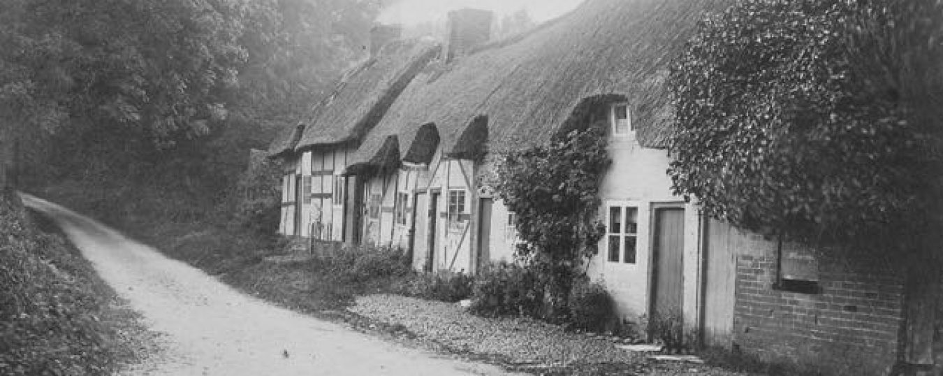
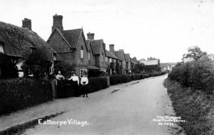
Eathorpe, with a larger population than Wappenbury, is bounded on the north and west by the Leam, and on the east by that river and its tributary the Itchen, the highest ground (278 ft.) being roughly in the centre of the parish. Much of the hamlet is taken up with the grounds of Eathorpe Park and Eathorpe Hall, the latter causing a slight westward diversion of the Fosse Way, which forms the village street. The village consists of a group of 18th-century redbrick houses with tiled roofs and a few timberframed cottages. At the southern end of the village is Eathorpe Hall, a long rectangular 18th-century building of two stories, built of red brick with stone dressings, and a tiled roof. The front is symmetrical, with a central porch, rectangular windows with flat stone arches, equally spaced, and finished with a projecting cornice. There are bridges across the Itchen east to Marton, and across the Leam north to Princethorpe, and west to Wappenbury. This last-named bridge crosses by Eathorpe Corn Mill, the pond of which was famous in the early 19th century for its eels, which were very large, but ‘not pleasant to look at, being not silver but spotted like serpents’.